Things to do in Akto
Explore top experiences
Top 10 attractions in Akto


Muztagh Glacier Park
Glacier Park is at a higher altitude and has many well-developed glaciers. You can see ice towers, ice caves and other landscapes here, as well as wild animals and plants, the scenery is beautiful and spectacular.Akto · >100 km from downtown

Baisha Mountain - Baisha Lake
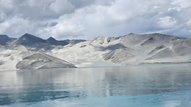
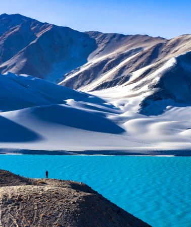
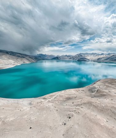
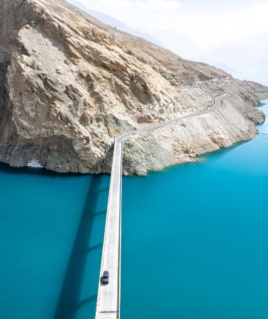
Baisha Mountain - Baisha Lake, located in Bulunkou Township, Akto County, 150 km from the Akto County seat. It is one of the unique views in Xinjiang, also known as "Xiangsha Mountain," which emits a sound whenever strong winds blow. In front of the mountain isBu Lunkule, and behind it is Qiakelake Lake, with lush aquatic plants and gathering water birds. The green mountain body is covered by white sand, partially hidden and undulating. Together with the snow-capped mountains at the peak and the lakes and rivers below, it forms a magnificent spectacle, breathtaking and reminiscent of a fairyland.Bu Lunkuleis a wetland natural and cultural view in Xinjiang, which means "lake at the foot of the mountain" in the Kyrgyz language.Akto · 97.1 km from downtown
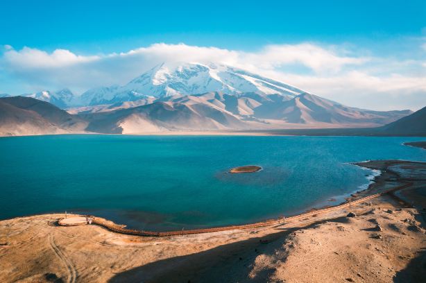
Muztagh Ata Peak-Karakul Lake Scenic Area
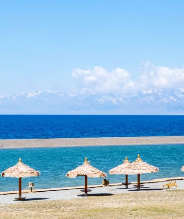
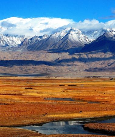
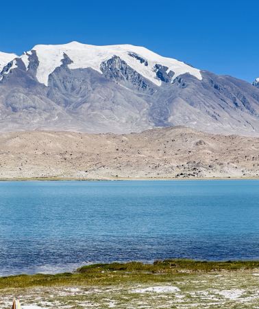
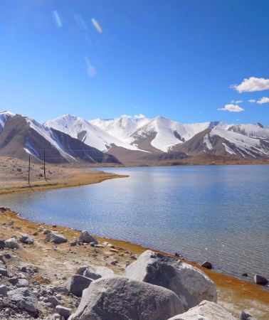
Karakul Lake Scenic Area is located at the foot of the "Father of Glaciers" Mount Muztagata. The lake gets its name "Karakul" from its deep and dark waters, which means "black lake" in Kyrgyz.Heihu. Before the lake stretches a vast grassland where herds of cattle and sheep graze during spring and summer, while waterfowl and wild ducks glide across the lake's surface, occasionally joined by foraging swans. Under the sunlight, the shimmering waters reflect the majestic Muztagh Ata peak, creating a breathtaking spectacle. Legends speak of a mysterious lake monster lurking in its depths—though its existence remains unverified, as no one has ever actually seen it. The lake water changes colors throughout the day as sunlight plays upon its surface. Normally, the water remains crystal clear and mirror-like. But when dark clouds gather, the lake transforms dramatically - turning as black as if filled with ink, truly living up to its nickname as theHeihuAt sunrise each morning, the shimmering lake waters transform like a celestial stage curtain—shifting between deep blue, pale yellow, and tangerine hues—creating an ethereal fairyland experience.Akto · >100 km from downtown

Pamir Plateau
Pamirs Plateau is located in West China, extending across Tajikistan, China and Afghanistan. Consisting of East and West parts, Pamirs Plateau has a number of high mountains. East Pamirs is broad and level, formed by two mountain ranges oriented from northwest to southeast and a group of rivers, valleys, lakes and basins. West Pamirs is formed by multiple mountains and valleys running in parallel from northeast to southwest. West Pamirs is distinguished by its varied terrain, with high mountains and deep valleys.China · Tashkurgan

Muji Volcanic Vent
Muji Crater was formed 1,500 years ago and is high above sea level. There are more than a dozen craters around, with different shapes, where you can enjoy the magnificent landscape.Akto · >100 km from downtown

Kezhou Glacier Park
Kezhou Glacier Park is one of China's lowest-altitude glacier parks and among the world's most spectacular glacial landscapes, covering an area of 224.8 square kilometers. The ascending glacial path alternates between flat terrain and muddy sections with winding turns. Originally named Oytag Primeval Forest Park, it's nestled in the western mountains of Akto County's Oytag Town on the Pamir Plateau, with elevations ranging from 2,300m to 5,300m, offering breathtaking scenery. The park features primarily natural ecological views and showcases rich Kirgiz ethnic culture.Akto · 57.2 km from downtown

Muji Wetland Mud Volcano Group
The Muji Wetland Mud Volcano Group is located in Muji Township, Akto County, Kizilsu Kirghiz Autonomous Prefecture, Xinjiang Uygur Autonomous Region. It is a tourist attraction that combines natural views, scientific research value, and sightseeing appeal. Renowned for its unique mud volcano formations, this area features a large quantity of diverse and well-preserved mud volcanoes, showcasing exceptional scientific, educational, and tourism value. The development of the Muji Wetland Mud Volcano Group provides travelers with an excellent opportunity to explore and understand nature. Rated as a national 3A-level tourist attraction, it offers abundant natural views and activities such as exploring the mud volcano formations and enjoying the scenery.Pamir PlateauThe magnificent views and more. Additionally, the attraction offers convenient transportation and well-equipped facilities, making it easier for visitors to explore this unique natural landscape. Whether you're a nature enthusiast, photographer, or casual traveler, the Muji Wetland Mud Volcano Group is a rare destination that allows you to appreciate stunning scenery while gaining knowledge and insight.Akto · >100 km from downtown

Karakoram Highway
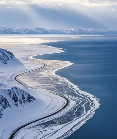
Karakoram Highway, also known as the Karakoram Highway, starts in Kashgar, Xinjiang, crossing the Pamir Plateau, and leads to northern Pakistan after crossing the border. It spans over 1,000 km in total, with over 400 km within China. Built in the last century through cooperation between China and Pakistan, the highway traverses the Hindu Kush and the western end of the Himalayas. Known for its challenging engineering, it is now an important international route and a classic route favored by self-drive and cycling enthusiasts. The section within China winds and climbs along the national highway. After entering Taxkorgan Tajik Autonomous County, the altitude rises to over 3,000 m. Continuing south, you arrive at, where the China-Pakistan border gate and boundary marker stand at an altitude of nearly 4,700 m.China · Tashkurgan

Muztagh Ata Peak
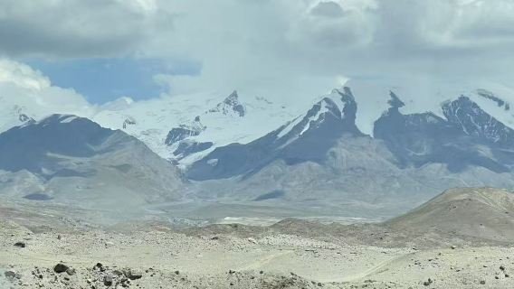
Muztagh Ata Peakstands on the Eastern Pamir Plateau in southwestern Xinjiang, at an elevation of approx. 7,500 m. It stands side-by-side with Kongur Tagh and Kongur Tiube Peak, forming the skyline of the western section of the Kunlun Mountains. In the local language, the mountain's name means "Father of Ice Mountains": the peak is covered in snow year-round, with multiple glaciers cascading down from the ridges and clouds often swirling around the mountainside. From a distance, it looks like a white-haired old man sitting on the plateau. In Tajik legend, this snow-capped peak is a symbol of pure love. It is said that an ice princess lived on the peak and fell in love with a snow prince on the opposite K2 Peak. The gods were enraged, splitting the two mountains that were once connected and separating the lovers; the princess could not stop longing for him, and her tears froze into glaciers along the mountain, while her white hair turned into the snow covering the peak. After hearing this story, the glaciers are more than just scenery when you look at the mountain. For the average traveler, the shores of the Muztagh Ata Peak-Karakul Lake Scenic Area at the foot of the mountain are a classic spot for viewing and photographing the snow-capped peaks. When the weather is clear and the lake is calm, you can capture the reflections of Muztagh Ata Peak, Kongur Tagh, and Kongur Tiube Peak all in one frame; around sunset, the setting sun turns the snow-capped peaks from white to pinkish-gold, which is the "golden mountain" moment that many are willing to wait for in the cold plateau winds. If you want to get closer to the ice, you can visit the glacier park, which centers on Glacier No. 4, and hike along the viewing trail to an observation deck at an altitude of over 4,000 m to get a close-up view of the glacier's edge. In the mountaineering community, this peak is considered one of the relatively easier 7,000-meter-class mountains to climb due to its gentle western slope and relatively dry climate, attracting many climbing teams every summer. Please note that the altitude at the foot of the mountain and by the lake is already over 3,000 m, and the glacier observation deck is even higher. It is advisable to slow your pace, bring plenty of warm clothing, and monitor your physical condition at all times to avoid altitude sickness affecting your itinerary.Akto · >100 km from downtown

Oytak Red Valley
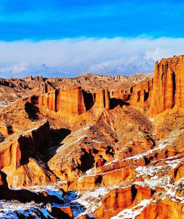
Oytak Red Valley, also known as the "bubble valley" of red mountains, is located at the confluence of the Oytak River and the Gaizi River in Akto County, which is considered the boundary between the Kunlun Mountains and the Tian Shan. On the way from Kashgar to Tashkurgan, fiery red mountains spread out along both sides of the river valley, stretching for over 1 km, and many travelers consider it a red prelude to their Pamir trip. It is also nicknamed the "Flaming Mountains of Southern Xinjiang," and many tourists feel that the red here is more intense than that of the Flaming Mountains in Turpan: the mountains are rich in iron oxide and almost devoid of vegetation, displaying varying shades of red from the foot to the summit, and the deeper you go into the valley, the more magical the colors and shapes become. What makes this valley quite recognizable are the bubble-shaped holes densely covering the rock walls. Years of geological movement and weathering have hollowed out the soluble parts of the rock mass into crevices and cavities, leaving strings of rounded "bubbles" on the cliffs. On many rock surfaces, you can still see traces of white salt deposits, while the stone walls on both sides have been polished by the wind into strange shapes resembling waves and ladders. Being there feels like walking into red fragments left behind by Mars on Earth. For photography, choose the soft light of early morning or evening, when the red color will be more saturated. If you happen to visit after rain, the moist rock walls and soil will show a deeper red, and wearing solid colors like white or beige will create a stronger contrast with the red mountains, making it easier to get great shots.Akto · 44 km from downtown
Experiences you can't miss in Akto
Featured Day tours in Akto
View all Day tours
5.0/5
· 4 reviews· 91 bookedFree cancellation
Instant confirmation
FromQAR 204.73
5.0/5
· 1 reviewFree cancellation
Book now for tomorrow
FromQAR 271.73
Free cancellation
Instant confirmation
FromQAR 265.53
4.0/5
· 1 review· 31 bookedFree cancellation
Instant confirmation
FromQAR 204.73

FromQAR 911.97
FromQAR 1,550.97

2.0/5
· 1 reviewFree cancellation
Instant confirmation
FromQAR 148.90

Free cancellation
Instant confirmation
FromQAR 148.28
Featured Travel photography in Akto
View all Travel photography
FromQAR 60.67


FromQAR 60.67

FromQAR 60.67

Instant confirmation
Book now for today
FromQAR 909.91

FromQAR 1,213.21

FromQAR 727.93

Instant confirmation
Book now for today
FromQAR 60.67
More things to do
Private Tours in Akto
View More Private Tours in Akto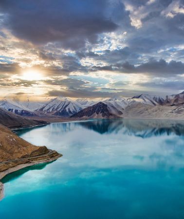


Group Tours in Akto
View More Group Tours in Akto
Free things to do in Akto
Pamir Plateau
China · TashkurganKarakoram Highway
China · TashkurganOytak Red Valley
Akto · 44 km from downtown
Tasha Ancient Path
Akto · >100 km from downtown
Ancient City of Kashi
Kashgar City · 36.2 km from Akto
Id Kah Mosque
Kashgar City · 36.3 km from Akto
Kashi Museum
Kashgar City · 38.9 km from Akto
Gaotai Ancient Homes
Kashgar City · 36.2 km from Akto
ke er ke zi zu hei shi bu luo
Akto · 33.9 km from downtown
What travelers say about Akto

皮勒恩谢逖October 21, 2026
4.0
Muztagh Ata truly lives up to its name as the "Father of Glaciers," offering breathtaking views of the glaciers up close. A separate shuttle bus ticket is required, as the high altitude makes hiking strenuous, and strong winds can easily cause altitude sickness. Weather is highly dependent on luck; cloudy days with poor visibility will diminish the experience. For a simpler experience, you can view the sacred mountain from the roadside.
Muztagh Glacier Park

金小牛儿October 14, 2026
5.0
Based on recommendations from online friends, we specifically chose this attraction for our trip. Overall, we had a fantastic experience. The scenic area was beautiful, the air was fresh, the service was excellent, and the facilities were comprehensive. We will definitely recommend it to our friends. We are extremely satisfied with this attraction and give it a five-star rating.
Baisha Mountain - Baisha Lake

阿尔瓦尔黄公望October 6, 2026
5.0
Karakol Lake, like a sapphire set at the foot of snow-capped mountains, has deep and tranquil waters that reflect the majestic silhouette of Muztagh Ata. Surrounded by clouds and mist, it showcases the purity and grandeur of the high-altitude lake, captivating all who behold it.
Muztagh Ata Peak-Karakul Lake Scenic Area

印象西南October 5, 2026
5.0
Arriving at the Pamir Plateau, one truly witnesses the magnificent grandeur of western China's landscape. Starting from Kashgar and traveling along the Karakoram Highway, snow-capped mountains, lakes, and deserts unfold before your eyes in breathtaking scenery—a must-do route in southern Xinjiang.
Along the way, you'll stop at White Sand Lake and Karakol Lake, facing Muztagh Ata Peak directly. The pristine snow-capped mountains reflected in the azure lakes create stunning photographs. The winding Panlong Ancient Road offers a unique and immersive experience. Along the way, you can also experience the unique culture and customs of the Tajik people—their simple and honest nature, the vast and tranquil plateau, far removed from the hustle and bustle of the city, a truly healing experience.
This is a border region, so a border permit must be obtained in advance; without it, you will not be able to pass. The overall altitude is very high, mostly above 3000 meters, making altitude sickness a common concern. Slow down your movements and bring oxygen cylinders and glucose. The temperature difference between day and night is significant; even in summer, a thick coat and windproof jacket are essential. The ultraviolet radiation is extremely strong, so sun protection and sunglasses are a must. The scenic areas are far apart and scattered, so driving or hiring a car is more suitable. Cell phone signal is weak in some sections, so downloading offline maps is recommended. The weather on the plateau is unpredictable; one moment it's sunny and clear, and the next it can be windy and snowy. There aren't many commercial facilities, so conditions are relatively basic; those seeking comfort and relaxation should expect that.
Seeing the Pamir Plateau in person makes all the travel fatigue worthwhile. For those who love natural scenery, the Pamir Plateau is definitely worth a visit.
Pamir Plateau

lq0804October 27, 2025
4.0
The big scene is very good. To see the Devil's Eye, you need to ride a horse across the stream to the deepest part. We didn't go there. We only saw the 1st and 2nd craters. One had water and the other was dry. But the Eighteen Arhats Peak in the distance was very nice.
Muji Volcanic Vent

Too***ieSeptember 30, 2026
4.0
It's a less crowded scenic area; the tour guide said it hasn't been open long and isn't fully developed yet.
It depends on your luck. If there are many clouds, you won't see the glaciers and snow-capped mountains. If the weather is good, you can see relatively high mountains. Its distinctive feature is its "black glacier," caused by carbon black aerosols that have made the rocks completely black.
When we went, it was cloudy at first, but the sun came out later. It was pretty good.
Kezhou Glacier Park

Benny JiangOctober 16, 2026
5.0
This wetland volcano scenic area is definitely worth a visit! The Devil's Eye and the Eighteen Arhats Peaks are truly breathtaking, a testament to the wonders of nature. The staff at the scenic area, including Natsume, were incredibly welcoming. When our car had a flat tire, they proactively helped us find someone to fix it at 10 pm. We were so grateful!
Muji Wetland Mud Volcano Group

正黄小菊May 3, 2025
5.0
The China-Pakistan Friendship Highway from Kashgar to Tashkurgan County and then to Khunjerab is very easy to drive and the scenery is so beautiful. Watch my video, there are two sections on the China-Pakistan Friendship Highway. If you don't have high sickness when driving, just go up all the way. I went there in March, when the winter snow just started to melt, it was as if people and cars were driving in an oil painting... Come and experience it!
Karakoram Highway

YoYo_9H7U5N1AOctober 1, 2026
5.0
Muztagh Ata stands majestically at the border of Akto County and Tashkurgan Tajik Autonomous County in Xinjiang, and is an important part of the western section of the Kunlun Mountains. Its body is rounded and broad, and its summit is covered with a layer of permanent limestone hundreds of meters thick.
Muztagh Ata Peak

杜楠嘟嘟May 22, 2026
5.0
You can see it on the way to Baisha Lake. The scenery is actually quite similar to the Rainbow Mountains of Zhangye, and the formation is similar as well. It's a good place to take some photos. There are just so many beautiful places in Xinjiang!
Oytak Red Valley


